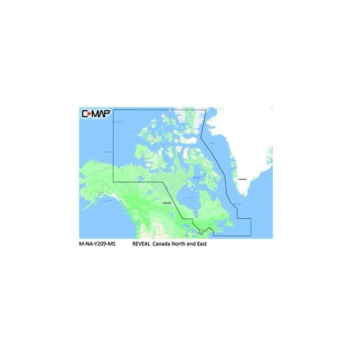
C-Map MNAY209MS Reveal Chart, Canada North & East
CAD $347.36
CAD $399.47
SKU
149-MNAY209MS
Experience the game-changing C-Map MNAY209MS Reveal Chart, Canada North & East edition, with innovative features and stunning visuals.
Introducing the C-Map MNAY209MS Reveal Chart, Canada North & East edition. This chart is a game-changer, offering you the very best of C-MAP technology. With its innovative features and stunning visuals, it brings the world around and beneath you to life in a completely new way.
Experience the power of Shaded Relief, a groundbreaking feature that adds depth and dimension to your charts. With this technology, you'll have a clear understanding of the underwater landscape, making navigation easier and safer than ever before.
Enjoy the benefits of Full-Featured Vector Charts, providing you with detailed and accurate information about coastlines, landmarks, and navigational aids.
Navigate with confidence using the Detailed Marina Port Plans, which offer comprehensive layouts of marinas, including dock locations, facilities, and services.
Get a clear picture of the underwater terrain with the Hi-Res Bathymetry feature. This high-resolution data allows you to see every contour and depth, ensuring you can navigate with precision.
Immerse yourself in the beauty of Aerial Photography, which provides stunning visuals of the surrounding areas.
Take advantage of the Integrated Genesis Layer, which combines sonar data with chart information, giving you a comprehensive view of the underwater world.
Stay up to date with the Satellite Overlay feature, which provides real-time satellite imagery for enhanced situational awareness.
Customize your charts with the Custom Depth Shading feature, allowing you to highlight specific depths or areas of interest.
Enjoy the convenience of Subscription-Free Easy Routing, which provides you with the most efficient routes based on your vessel's specifications.
Rest assured knowing that you'll receive 12 months of free updates, ensuring you always have the latest and most accurate information.
Stay informed about tides and currents with the Tides & Currents feature, helping you plan your journey with ease.
This product is proudly made by Lowrance, a trusted name in marine navigation. Don't miss out on the opportunity to enhance your boating experience with the C-Map MNAY209MS Reveal Chart, Canada North & East edition. Visit c-map.com for compatibility information and make your purchase today.


